
So we did a little roadtrip! Through the American Southwest. And when I say little, I really mean little. On a roadtrip through the American Southwest you can easily spend two weeks, camping at a multitude of places, checking out dozens of national parks, momuments, scenic areas, trails, you name it. But we didn’t do that. We started our trip on a Thursday morning and returned on a Saturday evening. And it was the perfect little get away, and a simple way to reset our internal clocks that were begging and screaming for nature. Here’s a quick rundown, with photos, of how our little trip went.

The drive from Los Angeles, to Utah’s border takes about 6-6.5 hours when you calculate stopping for gas or food or restroom breaks. But we weren’t headed just to utah, we were headed to Bryce Canyon. Which can easily add another three hours to your trip, as it should! On your way to Bryce canyon you are certain to drive by incredible views that will make you want to pull over and soak up the sun, the wild wild west, and the incredibly unique scenery.

If this is south Utah, Bryce is in the middle of the lower part of the state.
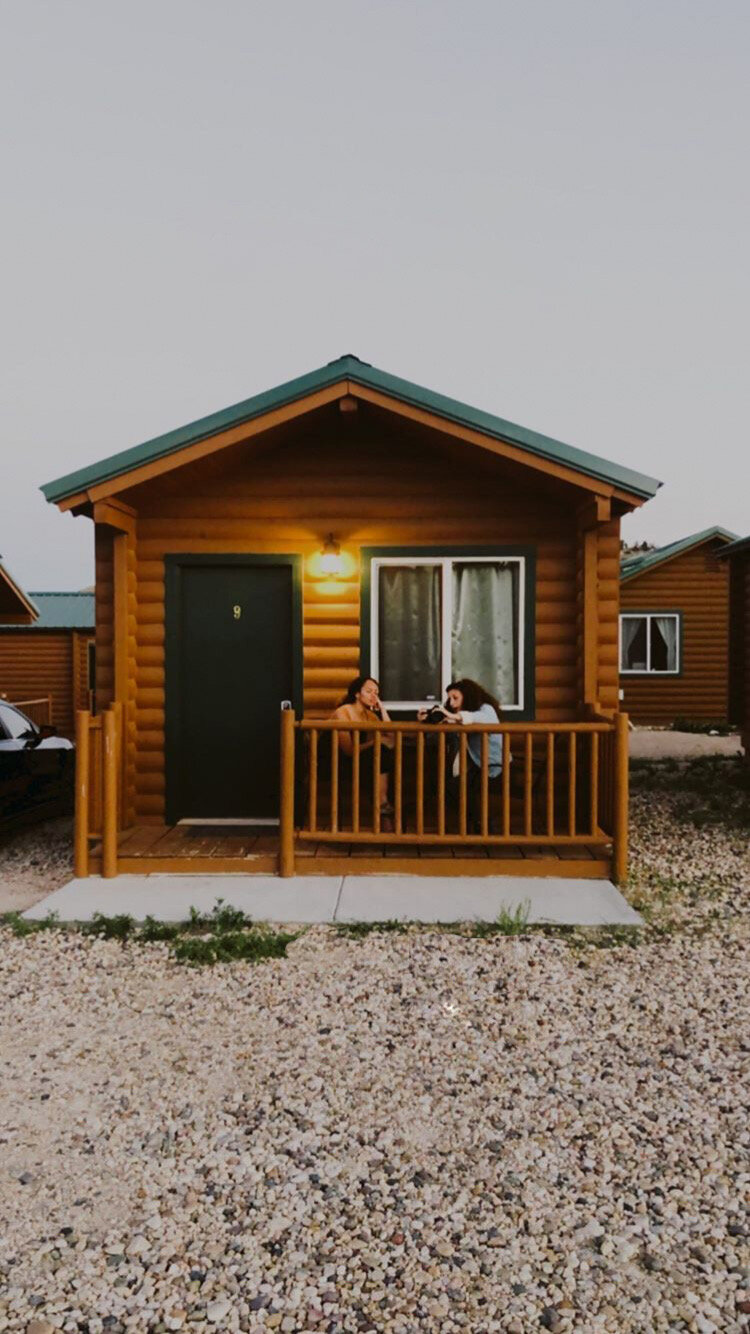
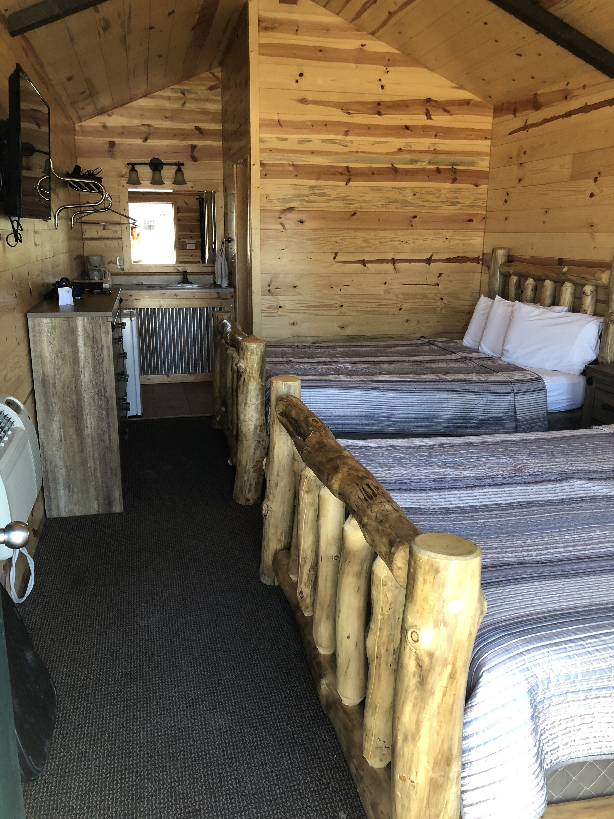
Where to stay near Bryce Canyon National Park?
The idea of being in a hotel where we were sharing facilities with strangers wasn’t exactly appealing during COVID-19, so I was very excited when we found the perfect place! Individual cabins in the city of Tropic, only a twenty minute drive from Bryce Canyon. While I do recommend this city, the hotel, and the BBQ spot across the street from the hotel, if you are looking to do Zion, Canyonlands, or Arches you may want to search for a city located at a halfway mark between the locations you desire. Tropic was perfect for us. We booked our own small cabin at Bryce Valley Lodging and were more than satisfied! You can check out the hotel for yourself by clicking here! Across the street from Bryce Valley Lodging was a BBQ spot called IDK BBQ and idk what they do to make that bbq so good, but I would drive all the way back to Utah to eat there again.
Dixie National Forest
If you are driving towards Bryce Canyon from the west or south you will likely go through Dixie National Forest. Dixie National forest is a little teaser of what you’ll see at Bryce Canyon, but it’s absolutely perfect. It’s just as stunning, but the crowds are smaller!

Stolen from my instagram story which you can see at @sofiasamarah
In Dixie National Forest we stopped at a little turn out labeled “Mossy Cave.” It was a simple little hike, but it was stunning. The trail runs along side a river, and there’s a vantage point with a waterfall. Given that it was summer there were many people playing in the water, it was a great stop to stretch your legs, and get a taste of the red rocks, the forest and see some small hoodoos.


Bryce Canyon National Park

Bryce Canyon, was established in 1928 and is iconic for its unique rock formations called “hoodoos".” Hoodoos are also referred to as tent rocks, fairy chimneys, or earth pyramids. Personally, I think fairy chimneys is the cutest name ever. As we were traveling during the pandemic, we stayed away from people by using our car and driving to the turn outs and view points. There are so many incredible view points, you think you’ll never run out of things to see!


The only real hike we did in Bryce due to crowds was the Bristlecone Loop Trail. We loved this hike. It was a small loop trail that was pretty empty, plenty of space for us to avoid strangers, and the views were incredible! You can find the trail head at the end of the main road in Bryce Canyon, Highway 63.

Bristlecone Loop trail
A quick look at the map for the trailhead. You can also start your backpacking trip at this location. Visit the national parks website to learn more about backpacking options in Bryce!


Queens Garden Trail in Bryce Canyon
Admittedly, we are disappointed we were unable to do the Queens Garden Trail, but we felt it was too crowded for our preference. If we had done that trail first thing in the morning we probably would have had the entire trail to ourselves. But, sadly, we did not. We were able to take in some incredible views at the Queens Garden overlook! It could never disappoint.

View from the look out for Queens Garden Trail


Headed towards Zion
Next we went to Zion National Park! We were actually able to do Bryce and Zion in the same day! With our early start in Bryce Canyon (6AM), we headed towards Zion around noon, and arrived about an hour and a half later! While this isn’t going to be the best way to absorb all these parks have to offer, it is possible to hit both parks and see the views and do small hikes.
Zion National park

While I know the Narrows are one of the most popular activities in Zion, unless you are doing a full day in Zion, I do not recommend trying to tackle the Narrows in a half day. A full day? YES. A half day? NO. Marty and I backpacked The Narrows back in 2017, it is amazing! But it is challenging, and wet, and cold, and stunningly gorgeous! While I am writing this (August 2020), there is a dangerous algae in the Virgin River - this is the river that runs through Zion. So I would proceed with caution before touching the water in the Virgin River. Read more about the algae at the National Parks Service website or click here.


These are a few photos from the Zion Narrows, October 2017

So if you go to Zion, but you don’t trek up the Narrows, what do you do? Drive up the main road in Zion National Park and pull off into the turn outs and enjoy the huge rocks, check out the Emerald Pools or Weeping Rock. There may be wildlife in the park too, we saw some goats just chillin on the side of the road. As of right now, Angels Landing is closed, but if it isn’t, and you aren’t afraid of heights, that’s probably worth checking out as well! Unfortunately I am afraid of heights, and will probably not be making it up there. If you do, let me know how it goes! I can live vicariously, securely, on steady ground.

One of the best ways to get around the park is by bicycle! You can rent bikes right outside of the park, and some bike shops even have electric bikes which will give you an extra boost while going uphill. If you do choose to rent a bike for exploring Zion, I recommend calling a day or so in advance and making a reservation. We had wanted to rent bikes but there weren’t any available when we arrived, c’est la vie.

food rec!
Right outside of Zion National Park is the town of Springdale. In Springdale you will find bike shops, canyoneering shops for all your equipment needs to trek through the Narrows, as well as breakfast and dinner spots. My favorite place to eat is Thai Sapa! Thai Sapa is walking distance from the park entrance and parking lots. If you like Thai food, this place hits the spot. We ate here in 2017 and it was just as good in 2020. This is the view from the outside patio at Thai Sapa.


heading west, nevada usa
The drive from Utah to Southern Nevada will take through some of the most beautiful mountains you’ll see in the American Southwest! It was honestly one of my favorite moments on the road, looking up at these towering rocks that the road cuts through. It’s enough of a reason to go to Nevada from Utah, just to enjoy the drive.
Valley of fire State Park, NV

Valley of Fire State Park was named for the red glow of the rocks during sunset. However it should have been named Valley of Fire because it is one of the hottest places I have ever been on the planet, yes I know I was there in the middle of summer, but wow 108 degrees! Granted, I tend to avoid hot places and this confirmed that that is the right choice. However, this place is STUNNING. The rocks are unique in their color and formation, and the park is deserted in the summer. Shock the desert is deserted.

Valley of Fire is a place in the US where you can see rock drawings from indigenous peoples. These markings are on the Atlatl Rock made by the Ancestral Puebloans, also known as the Anasazi, who were farmers from the nearby fertile Moapa Valley. You do have to climb about 25 steps to see the markings and stand on a balcony next to the rock. If you go during the pandemic, I suggest waiting for the current group to make their way down before heading up. We gave the group before us their space and they very much appreciated it, but a couple came up at the same time as us and it would have been nice if they had given us a few moments as well.

There are many stops in Valley of Fire, and while it was too hot for us to do all of them, we did see Atlatl Rock, Arch rock, Rainbow Vista, Fire Cave and Seven Sisters. We wanted to do the Fire Wave, but please please don’t do the mile long hike when the weather is 100+ degrees.
Important things to note: You may have a hard time finding water in the park, make sure to stop for water and take at least two gallons per person per day if you are planning on camping. You will need to pay a park entrance fee of $10 at the entrance via self registration. You can get more information about Valley of Fire by visiting the park site or clicking here!

Arch Rock in Valley of Fire State Park
Seven Magic Mountains

On your way through Las Vegas, take a moment and stretch your legs at Seven Magic Mountains! You can read my entire blog post at Seven Magic Mountains by clicking here. If you don’t want to read even more, I understand. I’ll give you a quick rundown. It’s a stop on a trip, it’s a fun place to take some pictures. It is not worth a trip specifically to the rocks. But if you do go, congratulations, you’re an influencer now!


So you’re ready to take off to the American South West! A few things to keep in mind:
This trip was taken during the Pandemic. Different states have different restrictions, and furthermore different cities/counties have different restrictions.
It is important to look at the National Park Service websites before heading to a National Park. If you are traveling with dogs, dogs are required to be on a leash in national parks at ALL TIMES. This keeps your animal and the wildlife safe.
Every National Park has a park entrance fee of $30. You can buy an America the Beautiful Pass which is $80. If you are going to even two parks on this trip, I recommend purchasing this pass. It will motivate you to visit another park near you and they last a year from purchase date. You can buy this at the entrance of the park. Three national parks and it pays for itself!
Wear a mask! We wore our masks the entire time, it’s the right thing to do, duh.
Some of the roads in Utah had limited cell reception, so download your maps before taking off.
Gas prices in Utah and Nevada, at the time, were about $1.90-$2.10.
It is entirely possible you will experience altitude sickness, especially in the area close to Bryce Canyon. Things that help with altitude are; ginger candy/drinks, no smoking or alcohol, lots and lots of water.
As you are entering natural areas, please practice Leave No Trace guidelines. If you are unfamiliar with LNT you can read more about it here!

enjoy your trip of the american south west
